Monday, September 30, 2013

Moab, UT - Tourist Hat Trick

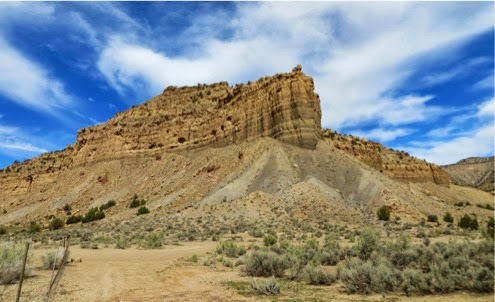
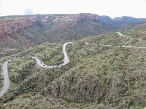
What to do? What to do? Only 1 day in Moab and what should we do to make the most of it? We had originally planned about 10 days in this area but, because of our RV problems, we found ourselves with only 1. Thus, it becomes a choice: what is the best thing to do? And, if you know Gary and me, we chose to hike. 2 of the best hikes in this area are the Fisher Towers and the Corona Arch trails. And, why not combine them with a scenic drive? Well, we can do this because the scenic drive gets us out to one of the hikes. But, it is a beautiful scenic drive, along the Colorado which is wide and flowing fairly smoothly at this point, though there are some small rapids as these rafters found out. But on either side of this scenic drive are towering red rock cliffs through which the Colorado has carved its passage. The deep red of the cliffs was covered with desert patina and surrounded at the base with rock and gravel that has fallen off. We wound through this narrow passage for quite a few miles before the valley widened out and ranches, farms and vineyards appeared.

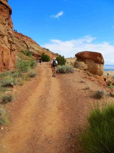
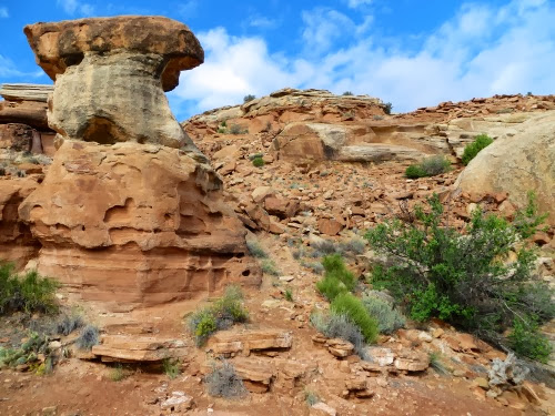
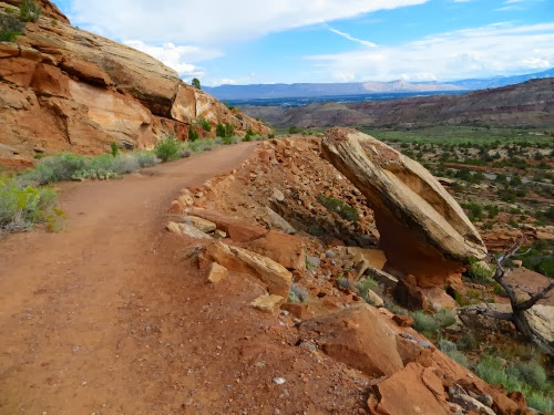
We arrived at Fisher Towers, put on our packs, grabbed our poles and set off. The hike is around some incredibly tall red rock hoodoos which have formed fins carved by water rushing off the cliffs. These fins spread out like the fingers of a hand and we walked around each and between them. Always ascending, oh, yes, always on an incline. But, isn’t that what a hike is supposed to be? Narrow red rock trail, often on slick rock. I love my Vibram soles which keep me on the slickrock like glue. In and out of one fin, around the point and then in and out of the next fin. Incredible views the whole way. Rocks of varying hues from light lavendar to brick red to deep orange.
ScenesalongHwy128backtoMoab-24-2013-09-30-20-15.jpg
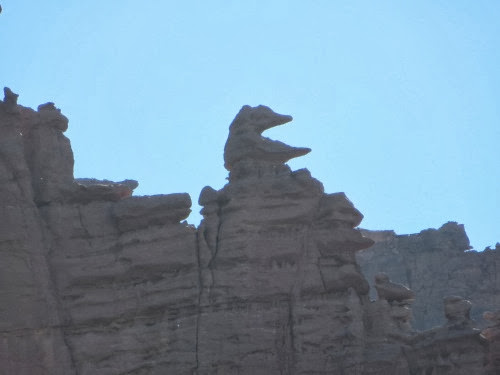
Hoodoos of comic book shapes. What does this shape look like? A little animal with a long snout spreading its legs out in front of it. Or maybe it’s a witch with a tall pointed hat. Depends on where you are in your hike and your view.
FisherTowersHike-69-2013-09-30-20-15.jpg
Large monolithic rock structures. Here is one called the Titan.

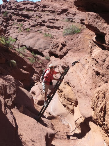
And, did I mention the ladder? Yep, a ladder to get you down one short cliff only to go up on the other side. Love those ladders. You can see the trail above me, the while line heading up towards the middle of the picture.
FisherTowersHike-23-2013-09-30-20-15.jpg
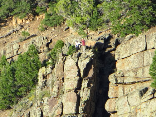
We also got to see some rock climbers. On the way out we saw them beginning their climb and as we were returning, we saw them at the top. Back at the parking lot, we saw 3 guys sitting in their lawn chairs, drinking their beer as they watched the climbers and applauded when each reached the top.

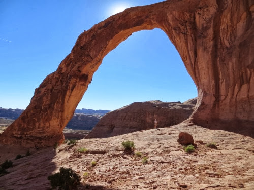
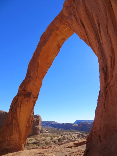
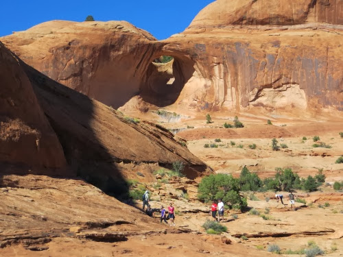
And, then it was on to our next hike: the Corona Arch. We had read that if you take only one hike in the Moab area, make it the Corona Arch. We had been in Moab several years ago but spent out time in Arches and Canyonlands NP and didn’t get to many hikes in Moab itself. Today we filled in. The hike weaves into the red rocks, over several ledges, around several corners, up a ladder, up a cable next to some footholds carved out of the rock. A fun challenging hike with a WOW at the end, when you round the last corner and spy the Bowtie arch and the Corona arch to its right. The trail is one of the most popular trails in Moab and the number of people on the trail when we were emphasized that fact. The arch in back of them is the Bowtie arch.
Corona%252526Bow-tieArchesHike-25-2013-09-30-20-15.jpg

Corona%252526Bow-tieArchesHike-6-2013-09-30-20-15.jpg

Corona%252526Bow-tieArchesHike-7-2013-09-30-20-15.jpg
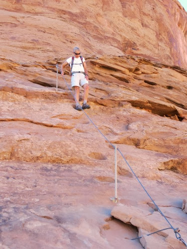
And, then there was the cable, stretched along the footrests carved into the rock. This was right after the ladder. I”m being pretty careful where I put my foot here.
Corona%252526Bow-tieArchesHike-1-2013-09-30-20-15.jpg
Both hikes were fun, challenging and a good workout. Would we do them again? You bet, the next time we’re in Moab.

And, that was our tourist hat trick: 2 hikes and a scenic drive.

7.3 mi., 2598’
Sunday, September 29, 2013

Moab, UT - Petrographs and Pictographs

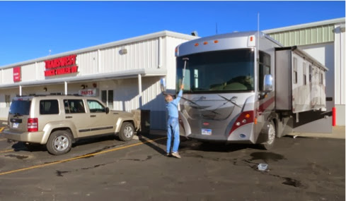
Between Grand Junction, CO and Moab, UT, just before the turnoff to Moab, are the pictographs and petroglyphs of Sego Canyon and the old ghost town of Sego. These are just calling our names - it’s time for some adventures. We awoke, ate a quick breakfast, cleaned the windshield, hitched up the Jeep and pointed our RV west.
FinallyPreppingtoLeave-1-2013-09-29-20-38.jpg
For the first 20 or so miles, we were watching the temperature gauge warily. On our trip to Grand Junction several weeks ago, after about 8 miles of driving, we could see that old temperature gauge marching up until it hit high, squealed and our engine light came on telling us to stop. Every time we started the engine up. Today, we watched, the temp gauge hit the middle and stay there. Whew. Maybe it really is fixed.

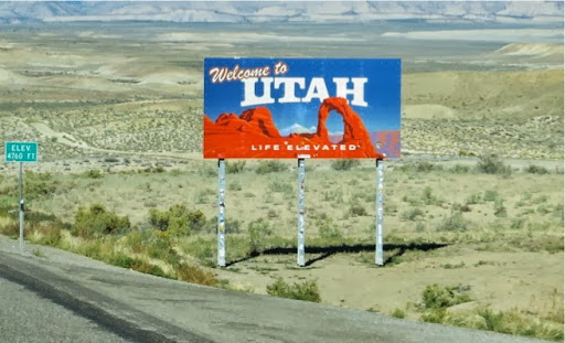
We crossed the border (looks like life is elevated only as high as 4760’.
I-70WestCOtoUT-5-2013-09-29-20-38.jpg
We hit the Welcome Center where a volunteer pulled out a copied page about Sego Canyon and turned off at the next exit which was Thompson Springs. I went into the truck stop, got up the the counter with 2 sodas and some chips and asked if we could park our RV there, unhitch the Jeep and head up into the canyon. How could she say ‘no’ when I had such fine purchases? And, of course she didn’t.
Now what makes the Sego Canyon pictographs and petroglyphs so interesting and important is that there are both pictographs and petroglyphs and that they represent 3 different styles, the Barrier Canyon style possibly from 6000 - 8000 BC, the Fremont style from 1000 - 1150 AD and the Ute style form the 1800’s. Obviously, these canyons have been inhabited throughout the years.

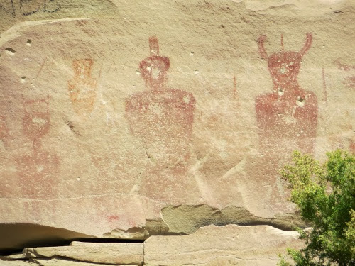
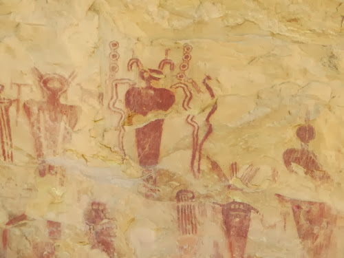
The Barrier Canyon drawings look like aliens with round horned heads and hollow eyes. I can easily picture these ghostlike creatures appearing in early sci-fi movies on TV. Note the absence of arms and legs. The artists were probably a nomadic people who used this canyon as a seasonal home during their travels, living in caves without any permanent structures. This panel was painted with natural colors.
SegoCanyonRockArt%252526GhostTown-21-2013-09-29-20-38.jpg

SegoCanyonRockArt%252526GhostTown-30-2013-09-29-20-38.jpg
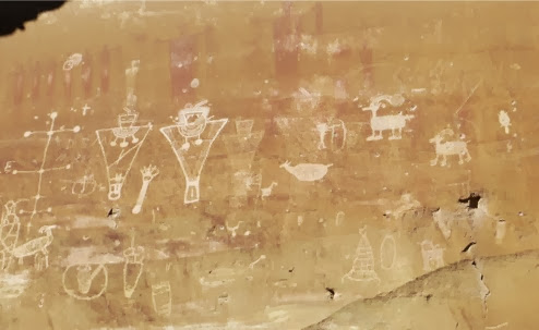
The Fremont style usually portray triangular figures in geometric shapes some with stick-like arms and some without. There are two distinct styles of Fremont art. The red figures at the top, which are difficult to see since they seem to have faded a bit, are the older style while the lower figures are the more recent Fremont style.
SegoCanyonRockArt%252526GhostTown-35-2013-09-29-20-38.jpg


The Ute style is of animals such as buffaloes and deer which were important to them since they were primarily hunters.

While I was there I met a woman from Rhode Island, where I lived and taught from 1968 - 1971. She was also a Girl Scout and knew a lot of kids who attended Camp Hoffman in southern Rhode Island where I was a swimming instructor for 2 years and a Waterfront Director for a year. How small is this world?

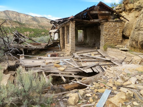
Next we walked on to find the ghost town of Sego which thrived from the early 1900’s when coal was used as a fuel but was deserted in the 1950’s when trains turned to diesel. There were a variety of roads and canyons in this area and it was difficult to find the actual town of Sego. We did find the cemetery and a few homes. If we had had the Jeep, we would have been able to cover more territory but, on foot, we were a bit limited.
SegoCanyonRockArt%252526GhostTown-9-2013-09-29-20-38.jpg
But, even if we didn’t find the whole ghost town, we enjoyed the walk among the colorful, layered rocks.
SegoCanyonRockArt%252526GhostTown-13-2013-09-29-20-38.jpg

SegoCanyonRockArt%252526GhostTown-17-2013-09-29-20-38.jpg

SegoCanyonRockArt%252526GhostTown-42-2013-09-29-20-38.JPG
Then it was on to Moab where we had a campsite reserved. Full hook-ups and a chance to do some laundry. Amazing how much laundry we’ve got after 2 weeks. We might spend all our time in Moab in laundry. Never. We have one day in Moab, 2 months of things to see and we’ve no time to spend on laundry, except in the evening.

2,  278'. big deal. 

Moab, UT - On the Road Again

Please note that the location heading above is very different from the one I’ve been using for a while. We have finally busted our way out of Grand Junction, CO and have headed on over to Moab, UT, a grand journey of 113 miles but a world of difference between the Journeys. Our RV is finally ready to hit the road and we are more than ready to do so.

We’ve been in Grand Junction with engine problems since September 21 (actually we arrived on September 8 and have been dealing with these problems ever since). And, I do mean problems, plural. We arrived with an overheating engine which barely got us over the Continental Divide even after we disconnected our Jeep. As this was being diagnosed and repaired, we developed a problem with the cockpit AC, in short, it didn’t work. Both of these problems could have been solved fairly easily but both were mis-diagnosed, a wrong part was ordered and one part came in damaged and had to be reordered. On the left hand cylinder, you can see how the metal is broken off and not complete. Obviously, this piece can’t seal at all.
JohnShowsGaryDamagedCompressor-2-2013-09-29-19-32.JPG
In the end, an undamaged compressor arrived and Stuart, one of their best techs, installed it in record time. We were ready to go. We had made reservations for the night in Moab, the RV was set to travel. All we had to do was hook up the Jeep and wave a fond farewell. Oops. why is the tech dragging out electrical connection testers?
WorkingonAirConditioningProblem--2013-09-29-19-32.JPG
Why is he putting his work coveralls back on? Why is the manager coming out? Yep, you guessed it, the Bad News Bears (Nancy and Gary) have another problem. Stuart’s asking about where our fuses are, he’s got out his voltmeter, and Gary gets out his wiring diagrams for our RV. (Last year when we bought this RV, he got online and downloaded the wiring diagrams from Winnebago, figuring he might need them someday.

Well, some day is NOW. He and Stuart, the tech, pore over the diagrams, tracing them and all of a sudden, Stuart, jumps up, strides out of the coach, lifts the hood and - voila! a bad switch. Yep, that’s all it was - a bad switch. Not a compressor, just a switch. The manager got on the phone to see if he could locate a switch in Grand Junction but it was 3:00 on a Saturday and there was no switch to be found. Stuart ‘jumped’ the wires, gave Gary instructions, closed the hood, put away his voltmeter, took off his work coveralls and we were as fixed as we were going to be. And, we were happy campers.

Meanwhile, the RV park in Moab had called back and had made a mistake: they had no space for tonight. Looks like another night at the Freightliner parking lot. But, we know that we will be hooking up the Jeep in the morning and heading out. We’re excited.

Our time in the Freightliner parking lot has been interesting. We’ve had:

        2 major engine problems

        several mis-diagnoses

        a wrong part ordered

        a damaged part delivered

Talk about the Bad News Bears. But, I’m sure, others have been in the same situation. I’ve met people who have sat in a Customer Service Center for weeks on end. We were lucky, we were only there 8 days. But it was a bit frustrating since it shouldn’t have taken that long. Here’s a really BAD SIGN: we were there so long that we knew the names of all the employees and were expecting an invitation to the employee Octoberfest.

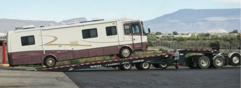
On the other hand, we’ve seen others with worse problems. Here’s what we saw come in yesterday. The towing guy brought this rig in, lined it up with the Freightliner bay and dropped it right into the middle of the bay. We were impressed.
AnotherBrokenRV-1-2013-09-29-19-32.jpg
Actually, the employees have all been friendly and helpful and embarrassed that all this is happening to us. Freightliner is also working with us on the costs: the bill for the compressor was completely torn up, of course, and other expenses were reduced considerably. We were plugged into their 50 amp power and could use their wi-fi. Life was good but this was not how I expected to spend September.

Meanwhile, Gary wants to replace our wimpy little Jeep Liberty with this manly vehicle.
Gary%252527sDreamDinghy-2-2013-09-29-19-32.JPG
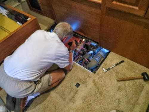
I also want to give credit to Gary for all he did to help solve this problem. He had the wiring diagrams which eventually helped solve the problem. Without these, we would have had to wait until Monday to call Winnebago. He also got the RV ready for the techs. Our engine is under our rear closet and everything had to be moved out. I can move clothes but the boards and metal framework under the them had to be removed. Gary also figured out how to remove our floorboards which also helped get to the engine. He’s been talking with the techs, learning, scurrying around trying to get things done that he can do so we don’t have to pay the techs to do some of the simple things. He’s been a busy boy these days.

As Nick Russell, the wordsmith, says, plans are made in jello, just stir that jello and try again. Tomorrow we start with a new batch of jello.

Tuesday, September 24, 2013

Grand Junction, CO - Thanks, John Otto

Well, we may be captives here in Grand Junction at the Freightliner but that doesn’t mean that we aren’t going to get out to get a bit of hiking in. In most cases, we found ourselves here because they they said the part might be in and we wanted to be here for the work. By the time we found out that the part hadn’t come in or that the wrong part had been ordered, it was a bit late to start a long hike. Today began the same way: the part was expected in the 10:30 delivery.

Knowing that we had some time, we toodled over to the Bagel bakery where they also bake other marvelous pastries. We found the Harvest Apple cinnamon roll perfectly heavenly, light, tasty and not too sweet. Reggae music was playing softly in the background and we could hear the hum of people happy to see each other and enjoying the company. What a great way to start the day.

When we got back, we learned that the part had not come in yet. Hmm. What to do? Sit around the RV working on paperwork? Boy, doesn’t that sound like fun? Oh, how about a hike? The Monument is right over there, enticing and close. Let’s go. We donned our hiking clothes, grabbed our poles, drove over and began our hike. About 2 weeks ago we started at the top of the canyon rim and hiked down but when it began to rain and hail, we turned around and hiked back up the hill. Today we decided to start at the bottom, hike around Independence Monument and head on over to where we had turned around the last time.

What a beautiful hike and we owe thanks to John Otto who designed and built it. When he arrived in the area and visited the canyons he was so enthralled by their beauty and uniqueness that he said: "I came here last year and found these canyons, and they feel like the heart of the world to me. I'm going to stay and build trails and promote this place, because it should be a national park." And, built trails he did. Nicknamed the ‘Trailbuilder” he used a pick and shovel to carve out the trails, making the canyons accessible to everyone.
IMG_0909-2013-09-24-15-25.JPG
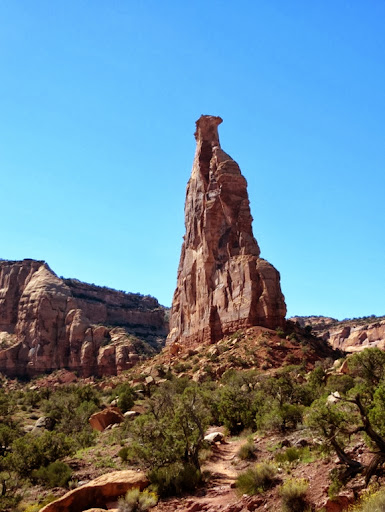
One of his favorite rock monoliths was the one he called Independence Monument. He liked it so much that he had his wedding ceremony in its shadow. On July 4, 1911, he climbed to the top and planted the US flag, a tradition that is carried out still today.
IMG_0893-2013-09-24-15-25.jpg
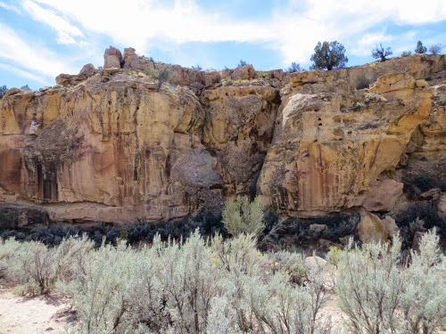
We thoroughly enjoyed the hike, as we rounded these marvelous rocks. They were all colors of red and many had the desert patina finish.
IMG_0907-2013-09-24-15-25.JPG
When we turned around to head back down the trail, we looked at Independence Monument and, sure enough, we saw two guys at the top. I didn’t see a flag but they were up there enjoying their victory. Look closely at the top and see the two guys in white t-shirts on the crown.
IMG_0921-2013-09-24-15-25.JPG

IMG_0944-2013-09-24-15-25.JPG
Marvelous hike, surrounded by all rocks in every color from deep yellow to deep red. This hike had the WOW factor around every turn. This is a lesser known and visited Monument in the National Park System but all with whom I talked thought it awe inspiring.

8 mi., 1368'

Saturday, September 21, 2013

Grand Junction, CO - 2 BONUS Nights at Freightliner

‘Buy an RV’, my husband said ‘and see the world.’

Hmm. If his world is the Freightliner parking lot, then we’ve fulfilled his dream. My dream was a bit different.

Yes, we are back at Freightliner with the same problem: we’re driving along at 60 mph, on a flat road with outside temps at 79 and our cooling warning light comes on and we get this screal in our ears. What’s wrong with this scenario? Lots. As I related on 9/17, we elected to continue on to Montrose where we had a reservation rather than backtracking to Grand Junction for more repairs. Today, it’s Saturday and, thinking we might be able to get into Freightliner today and wanting to avoid Sunday’s thunderstorms and high winds, we drove back to Grand Junction. We ONLY had the cooling problems twice on this trip, probably because it’s downhill from Montrose to Grand Junction. We can coast with minor problems. All we need to find is downhills.

So, here we are in the Freightliner parking lot, waiting until Monday when they might be able to fit us in.

Gary’s pretty mechanical and likes to see if he can find the problem himself, because, if he can find it, either he can fix it or can point it out to the mechanic. Either way, we can save money. At $135 per hour, why pay a mechanic to take up flooring. We'd rather pay a mechanic to fix the engine. Is this his favorite thing to do? Guess again. He would rather that nothing break. However, things break. So, while we were sitting here in the lot, he took apart some of our flooring to get to the engine. Here he is in a typical pose, looking at something mechanical to see how it works.
EngineAccess%252526EnginePhotos-1-2013-09-21-15-28.jpg
Boondocking with the BLM in Utah for 5 days was the plan, not dry camping in the Freightliner parking lot. But, hey, isn’t that part of the adventure?

And, as one of my co-workers used to say: ‘Can’t complain.’ Nope, and I’m not complaining. I”m just reveling in the irony. It is what it is. Besides, an old Taoist Saying has it best:

The journey is the reward

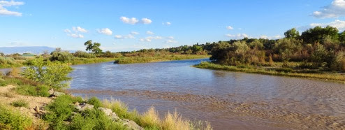
We can look out one window and see the Colorado National Monument. We can look out the other and see the Grand Mesa. We took a walk along the Blue Heron Trail, which goes for miles along the Gunnison River. There’s a wildlife refuge between the trail and the river and we saw deer, rabbits, ants, lots of ants and others biking along the trail. A beautiful walk alonside the river to end our day.
BlueHeronTrail-8-2013-09-21-15-28.jpg

5.5 mi. 100’

Wednesday, September 18, 2013

Montrose, CO - Faster, Faster, I'm Too Cool to Hike in a Poncho

I actually toyed with several subtitles for this entry: ‘Lunch by the Lake’ but that seemed too alliterative and too blah. You could sleep on a blog entry titled: ‘Lunch by the Lake’ Then I thought of ‘Luckily I Clipped my Toenails Last Night’ but that seemed too personal and, who wants to read about toenails? Yet, both of these titles are pertinent and describe our day but I finally landed on the title I have above. But, let me start at the beginning.

Yesterday, at the Black Canyon NP, we thought seriously about making a hike into the canyon itself down to the Gunnison River at the bottom. It’s possible, though it’s a downhill scramble and probably more of a slog than a hike. At one point, it’s so steep that they have a chain rigged to pull yourself up the hill. Intriguing, challenging and a claim to bragging rights (though with whom I don’t know), however, tumbling down a muddy rocky slope is not my cup of tea. Nor is fighting gravity by pulling myself up by a chain. In the end, it’s only 1800’ and I had another hike which was a much prettier hike, along a scenic byway and also 1800’ down to Morrow Point Reservoir, right on the lake. How do you think I voted here? Did Gary have a vote? Of course, but he was probably also more intrigued by the Gunnison hike than desirous of doing it.

And, that’s how we chose to hike down to Hermit’s Rest in the Curecanti National Recreation Area. The Curecanti is a beautiful area formed around 3 reservoirs built to control the Gunnison and make it more useful both for recreation and for irrigation. The Morrow Reservoir is the middle one and generates most of the power for the dams. It is hemmed in by the sheer walled cliffs of the Gunnison and is difficult to reach. But, we found a way. There is a trail called Hermit’s Rest which starts at the road which circles the reservoir and winds up down at the shore line where there is a campsite with 9 picnic tables and 2-room outhouse. Pretty neat huh?

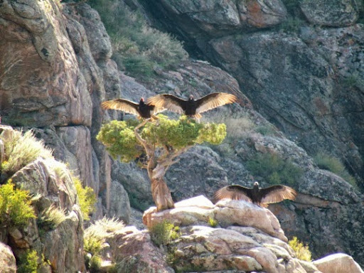
We drove over from Montrose on US 50 which has a long section of highway construction which held us up a bit but finally we got through, turned off on highway 92 and headed north. A beautiful winding, curvy drive which curls around the Morrow Reservoir, gaining altitude with every mile and winding in and around all the creek beds which feed into the Morrow. We stopped at several scenic views and at one saw these 3 large vultures with their wings spread wide to dry. They held this pose for several minutes. Others were circling overhead.
PioneerPointonMorrowPointReservoir-9-2013-09-18-19-55.jpg
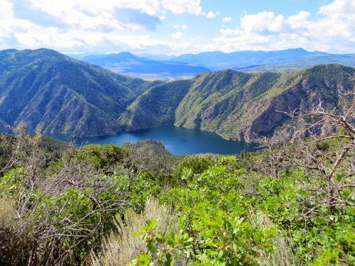
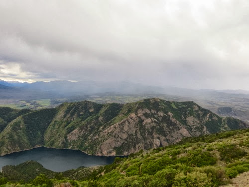
We finally found the trailhead where we met several others also taking in the views. Here one can not only see the deep blue of the Morrow below but also the steep walls of the cliffs surrounding it and beyond those the rugged, craggy peaks of the San Juan Mountains. I could have sat for ages just taking in that magnificent sight but Big Gar wanted to start our hike. We had awakened at 6:00 but here it was, 10:30 and we were just starting out. We obviously had stopped several times at each viewpoint and had been held up by construction but, we know Colorado and the rains come every afternoon. We had to get our rears in gear or we’d get rained on.

I took this picture from the top of the canyon, 1800’ up. The lake looks pretty close here, doesn’t it? Ha, don't I wish?
HermitsRestTrail-33-2013-09-18-19-55.jpg
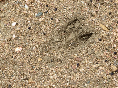
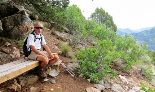
The hike is 3 miles long and 1800’down. However, the first 1 1/2 miles drop only 600’ leaving s drop of 1200’ for the last 1 1/2 miles, much steeper. Going down I was glad that I had clipped my toenails the night before, my toes seemed to be squished into the toes of my boots a good part of the time. The trail is a beautiful one and well-maintained. Benches are placed at regular intervals and not only provided a view of the lake below but also provided some needed rest on the way back up the trail. We traveled through two different environments. The top of the trail was short sage bush and other scrub bushes but the bottom was oak and pine. We usually hike in desert climates and hiking in this alpine climate was a real change for us. We saw no animals but did see some signs that deer had passed this way. (or does that look like a Playboy bunny?) Not only did we see some scat but also this print in the trail. Nothing to worry about. I don’t want to see a mountain lion print nor a bear print as I have heard that you can see on this trail.
HermitsRestTrail-28-2013-09-18-19-55.jpg
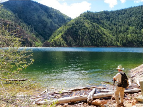
At the bottom we rested, had lunch by the lake and enjoyed the solitude. We heard nothing else but the wind through the trees, an occasional screech of a bird on high and the rustle of squirrels in the brush.
HermitsRestTrail-15-2013-09-18-19-55.jpg
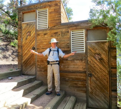
Hey, here’s a strange structure. I’m thinkin’ it looks pretty nice for a campground a the bottom of a 3-mile trail. Built in Colorado rustic.
HermitsRestTrail-12-2013-09-18-19-55.jpg
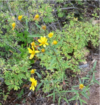
We took off our socks and shoes and let our feet rest. But even though we relaxed, we were ever mindful of the grey clouds marching across the sky over the ranges towards us. We felt a few drops, got out our ponchos and put them in an outside pocket on our packs and took off up the hill. The raindrops stopped but that did not mean that we were in the clear. Black clouds were still rolling in. These flowers along the trail sure will appreciate the rain more than we will.
HermitsRestTrail-5-2013-09-18-19-55.jpg
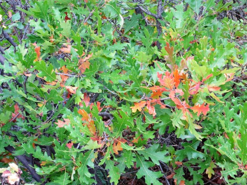
The trail was covered with flowers, yellow, purple and pink. We also noted some small scrub oaks beginning to change color.
HermitsRestTrail-7-2013-09-18-19-55.jpg
And, yes, the bottom half of the trail has 2/3’s of the elevation gain. Oof-da. Am I ever out of shape. But we kept chugging along. Of course, every now and then the chug gave out and we took advantage of the benches.
HermitsRestTrail-11-2013-09-18-19-55.jpg
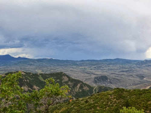
We finally reached the top, ahead of the rain. Whew. I certainly did not want to hike uphill in ponchos in the rain. The weather at the top was much cooler and the wind had picked up. We were definitely in store for some rain. We could see it coming over the mountain ranges to the south, moving inexorably towards us.
HermitsRestTrail-3-2013-09-18-19-55.jpg
And, getting closer with each minute.
HermitsRestTrail-1-2013-09-18-19-55.jpg
Whew, we made it to the top in time to avoid the rain.

At the top, we met a family setting up lunch. They had hiked a different trail about 10 miles away, had gotten drenched and had come here to eat their lunch. Luckily we had missed all this. We then continued along route 92, curvy, uphill and in and out of all the small creek drainages. Who in the world plans these roads and how in the world do they ever get them constructed? What marvels.

Hey, is that snow up there? I don’t think so since the other peaks in the area do not have the same coating but it sure looks like snow.
ViewsfromCrawfordStatePark-8-2013-09-18-19-55.jpg
Then the rain came with a vengeance. Sheets and sheets came down, followed by dime-sized hail. We saw several muddy run-offs coursing over the roads. Colorado is rocky to begin with and what soil there is can only absorb so much water. With all the rain Colorado has had recently, that limit was passed several days ago and all the water can do now is rush towards the lowest spot. And, then it began to rain harder. We stopped one time since we could hardly see out of our front windshield. But finally it let up and we could continue on home.

We got back about 5:00, just in time for dinner. A long day but a beautiful drive and a neat hike.

I’ve got 1300+ words here. Gary says he could tweet it better: ‘Found a hill, hiked down, came up. Beat the rain.’

6 mi., 1900’

Tuesday, September 17, 2013

Montrose, CO - Black Cyn of the Gunnison

Today we’re moving down the road a bit, 62 miles to Montrose, CO where we hope to hike around the Curecanti National Recreational Area and visit the Black Canyon of the Gunnison NP. After the time spent in the Freightliner Service Center, is our RV ready for travel? Nope. We had the cooling alarm and light 4 times before we had gone 20 miles. How come we can drive it 10 miles with Tom from Freightliner who has his computer plugged in to our engine and have absolutely no trouble? But, when we are ready to travel, we have problems? Isn’t that the way it always happens?

At this point, rather than driving back to Freightliner, we decided to continue on to Montrose where we had a reservation and then hit Freightliner in 5 days on the way back to Interstate 70 which we planned to take into Utah. And, after those 4 instances, we traveled without problems. I really think that our RV really does not like change and fights us. When it sees that we are going to change, it prevents our slide from closing and then, when we finally do get on the road, it prevents the engine from cooling. An RV with a mind of its own. I’m sure we do not have the only one.

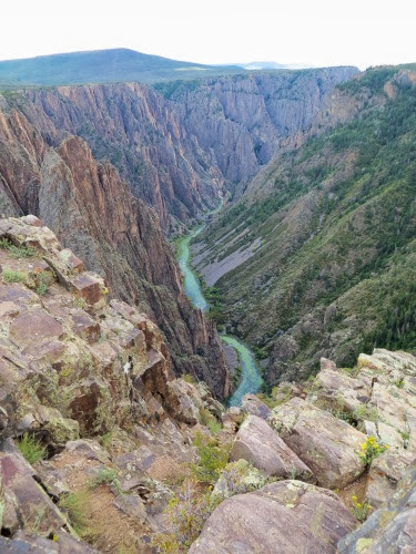
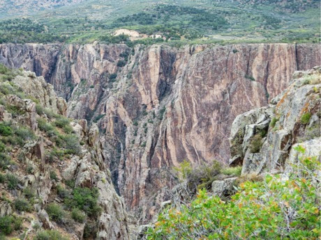
We got to Montrose, set up and headed on over to the Black Canyon of the Gunnison NP. What an interesting facet of geology, miles of gently rolling hills on either side with this 2600’ deep gash in the middle separating them. It is called black because it is so deep and so narrow that sunlight barely penetrates, even at midday. The walls are a deep grey with very little to ameliorate the somber tone.

Geologist Wallace Hansen put it this way: ‘Some are longer, some are deeper, some are narrower, and a few have walls as steep. But no other canyon in North America combines the depth, narrowness, sheerness and somber countenance of the Black Canyon of the Gunnison.’ But it was the waters of the Gunnison River which formed this deep, steep gash in the earth. And, the Gunnison flows extremely fast through this canyon. In just the 48 miles of its length, it loses more elevation than the entire Mississippi River does in its 1500-mile path from Minnesota to the Gulf. In one 2-mile stretch it drops 480’.

Yet this rushing torrent is extremely patient. Using only water, it spent 2 million years carving two parallel 2600’ high walls out of gneiss and shist, two extremely hard rocks. It carved so fine and so deep that only 1100’ separate the two sides and at times it is deeper than it is wide. It carves 1” out of this rock every century and the width of a hair every year.

We saw a movie at the Visitor Center on the south side that told about a group of explorers, commissioned to survey the river who chose to ride down the river in wooden boats. One boat splintered in the rocky channel, the boat with all their supplies. Another expedition consisted of 2 men who floated down the river in a rubber raft. At one point they came to a bubbling churning, foaming rapids. One of them said, ‘What the heck,’ dived in and disappeared around the corner. The other stood on the bank for a few minutes then did the same thing. When he emerged, he found his companion next to him on the bank. I’m not sure about the ‘what the heck’ but I’m sure that I do not have the same ice water flowing in my veins that these 2 did.

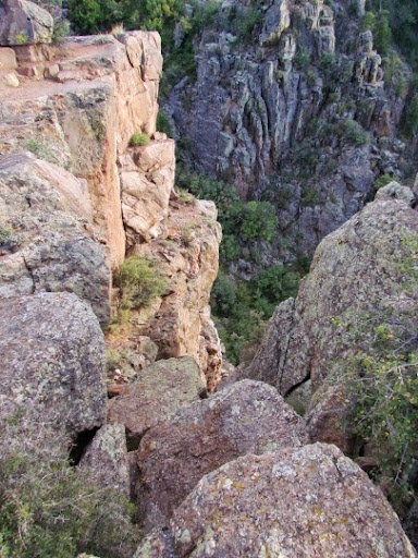
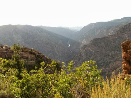
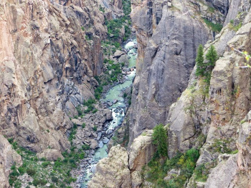
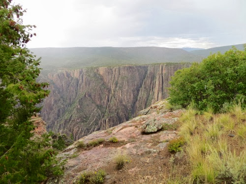
We drove around Rim Drive which follows the south rim with many short trails to overlooks. Here are some pictures I took from them. The Gunnison is that thin ribbon of green at the bottom.
Clouds%252526SunInteract-32-2013-09-17-20-14.jpg

VistBlackCanyon-26-2013-09-17-20-14.jpg

VistBlackCanyon-22-2013-09-17-20-14.jpg
Here is Painted Wall.
Clouds%252526SunInteract-33-2013-09-17-20-14.jpg

Clouds%252526SunInteract-16-2013-09-17-20-14.jpg

Clouds%252526SunInteract-44-2013-09-17-20-14.jpg
I’m sure this is not where I’d stand.
Clouds%252526SunInteract-2-2013-09-17-20-14.jpg
Deep, dark, mysterious. All these describe the canyon. And, except for a few minutes of sunshine, we saw it on a rainy, cloudy day which only added to the somber, grey nature.

Finally, as we were heading back to our campsite, we saw the sun peeking through some of the lingering clouds.
Sun%252526CloudsoverMontrose-1-2013-09-17-20-14.jpg

Sunday, September 15, 2013

Grand Junction, CO - Serpents Trail

One of the most popular hikes in the Grand Junction area is the Serpents Trail which goes up the old road into the Colorado National Monument. Many use it as an aerobic workout like the two who started right before us in their trail running shoes, who ran up and down the trail. Hmmm. Not us. We planned to use it as a training hike so we strapped our packs on our backs, filled with water, grabbed our poles and took off at a much slower pace. We thought we’d go up, head down and retreat to the RV for some ‘administrative’ time. You know: the cleaning, the e-mails, the finances, etc.

The trail itself has an interesting history, having been built by the legendary John Otto. His grand vision was to connect Grand Junction, CO to Moab, UT via a series of shorter scenic roads and part of a transcontinental road system. He began the road in 1912 and continued sporadically until 1921 when Mesa County took over. His road was extremely curvy and gained altitude fast, and it was here that cars had to ascend backwards so that gravity would enable the gas to reach the motor. It is amazing to look at some of the work required to make this road viable. Here’s a wall that was built to help hold the road up.
HikingSerpentsTrail-24-2013-09-15-22-12.jpg
Culverts were built to help with drainage. Massive boulders were moved, sections or rock were dynamited to make the road level. Here’s a picture from the NPS showing men placing drill bits by hand into the correct place for holes for dynamite.
OuttheWestEntrance-17-2013-09-15-22-12.jpg
Imagine backing up this road, quick elevation changes, no guard rail, only wide enough for 1 1/2 cars in most places. Later the National Park Service built a different road into the park, using a part of this road. The rest became the Serpent’s Trail.
HikingSerpentsTrail-22-2013-09-15-22-12.jpg
It was a beautiful trail, winding through some fantastic rock formations, opening up new and better views of the Monument as we climbed higher which helped mitigate the strain of climbing. At one point you can look down and see the new road winding up beside this trail through the rain.
HikingSerpentsTrail-17-2013-09-15-22-12.jpg
Motorcyclists love the road and bicyclists do also - probably for different reasons.
HikingSerpentsTrail-23-2013-09-15-22-12.jpg
We reached the top, turned around and - shucky darn, here’s the rain again. We walked a bit hoping that it was going to be a light sprinkle but, nope, a full fledged rain. We donned our ponchos and kept walking on down.
HikingSerpentsTrail-6-2013-09-15-22-12.jpg
At the bottom, we decided to take another trail which also had some wonderful rock formations. But, since it wound by the small creek, it also had some wildflowers.
HikingSerpentsTrail-10-2013-09-15-22-12.jpg
Nice hike but we turned around to get back to the RV for that ‘fun’ stuff.

4.94 mi., 1020’