Saturday, June 28, 2014

Newhalem, WA - Let There Be Light

It’s going to rain all day today so it’s the perfect time to tell you about James Delmage Ross. Well, everyone called him JD, even his employees, so I will also. Born in 1872 to Scottish parents, he was fascinated with electricity and even flew a kite just like Ben Franklin. He graduated from college and taught for a few years but then gave this up to prospect in the Klondike. Dull stuff and probably not challenging enough for him so he then left for Seattle. Being self-taught in electricity, he found some jobs but, when Seattle decided to built a municipal electrical plant, he walked into the mayor’s office and asked to design and build the new plant.

Experience? None. Training? None. Schooling? Nope. But, when asked about these, he answered, ‘None but where will you find anybody that has?’ And, he was right, no one had these back at the turn of the century. 2 weeks later he returned with his blueprints and got the job. Interestingly, he was not chosen as the first superintendent but, when that guy resigned a year later, Ross was appointed to the position, which he held for almost the rest of his life.

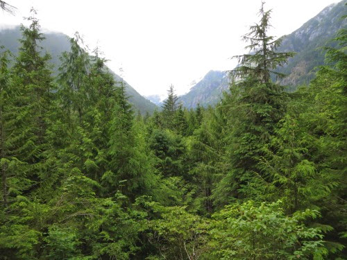
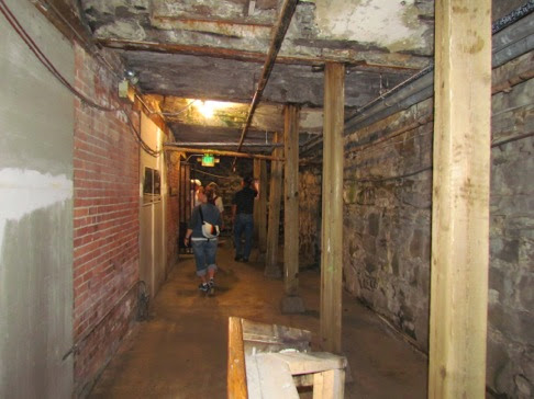
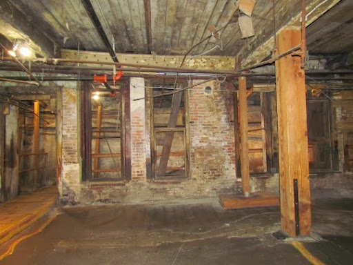
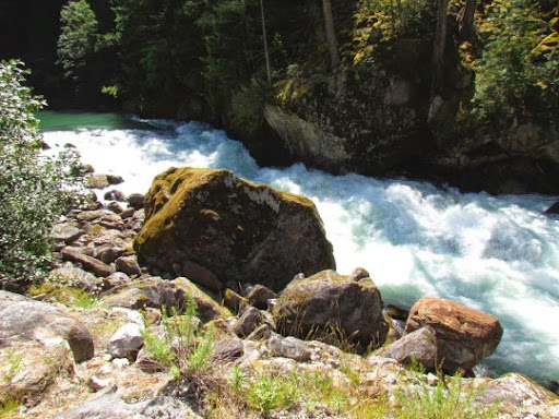
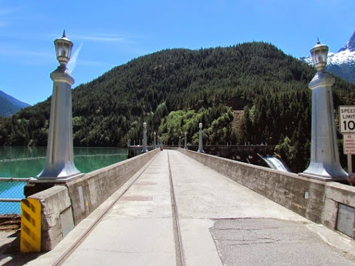
His grand vision was to build 3 dams on the Skagit River to provide the electricity for Seattle. First he built the Gorge Dam. This is very near the road through the park and quite near our campground. We drove up to see the dam, the bridge and the falls nearby. On the way we stopped where the road goes through a narrow canyon to look at the Skagit River rushing along. It was difficult to see the actual water since it seemed to be all froth and rapids. Since it is so narrow and rocky here, it was really rushing by. A young couple who stopped when we did told that they had not seen it this full in the 17 years that they had lived in the area.
ViewsinNorthCascades-9-2014-06-28-20-30.jpg
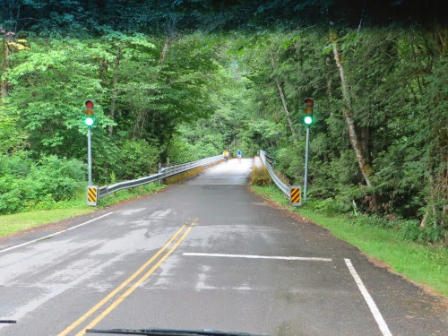
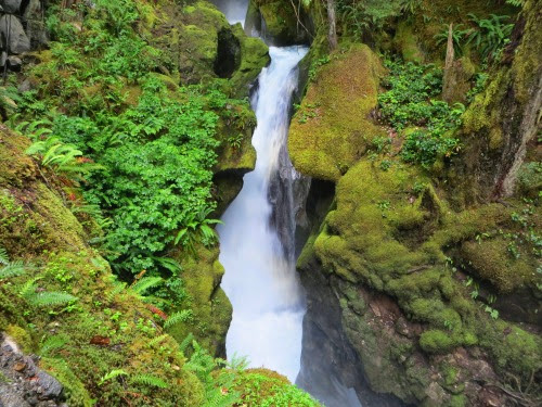
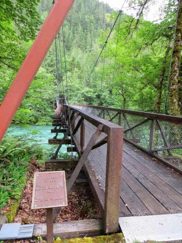
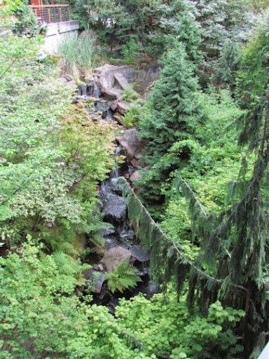
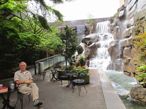
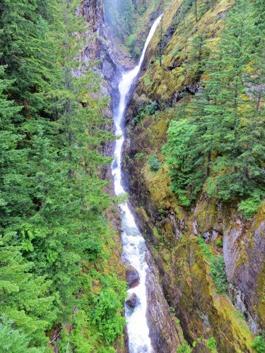
A bit up the road we stopped at a turnout and walked back over a bridge that spanned a deep canyon with a small creek at the bottom. Up the canyon we saw this marvelous waterfall.
ViewAlongSkagitRiverHydroelectricProject-6-2014-06-28-20-30.jpg
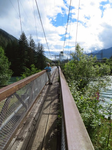
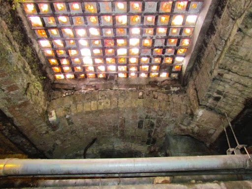
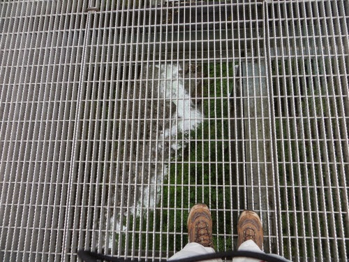
Below the grated bridge walkway, we could see the creek. (I really do not like grated walkways. Although I try hard not to look down, my eyes seem drawn to the depths below.) Luckily, you can’t see my feet shaking in this picture.
ViewAlongSkagitRiverHydroelectricProject-7-2014-06-28-20-30.jpg
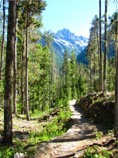
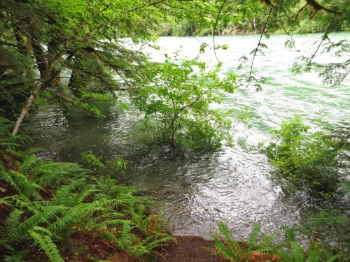
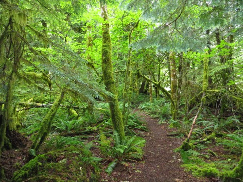
We also took a nice path around a bluff near the bridge that took up nearer the river. Beautiful views everywhere you looked.

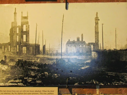
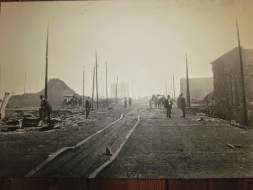
Now, back to Gorge Dam. When it was finished in 1924, President Calvin Coolidge pressed the golden key and the generators began transmitting power 100 miles to Seattle. Next came the construction of Diablo Dam, further upstream. Interestingly, Ross, who ran a municipal utility, had to continually watch out for the private energy firms who were complaining that a municipal energy firm was nothing but Socialism. Their whining worked and Mayor Edwards fired Ross in 1931. Then, the voters, who rather liked the municipal utility and certainly didn’t see this as Socialism, had a special election and elected a new mayor, whose first task was to rehire Ross a few months later.

Ross had one simple goal: deliver electricity efficiently and cheaply to the citizens of Seattle. He believed that ‘anything was possible with electricity.’ To this end he planned two more dams on the Skagit, the Diablo Dam and the Ruby Dam. To popularize his projects he arranged tours of the dams and powerhouses.
DiabloLakeBoatRide-1-2014-06-28-20-30.jpg
He wanted people to see where their electricity was coming from and to enjoy the beauty of the North Cascades region. Here’s a tour schedule. He’s thought of everything: soft music to lull you to sleep and ‘Lazy Mary, Won’t You Get Up’ to wake you up.
DiabloLakeBoatRide-2-2014-06-28-20-30.jpg
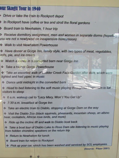
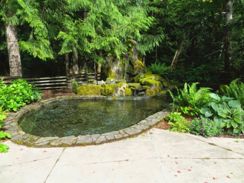
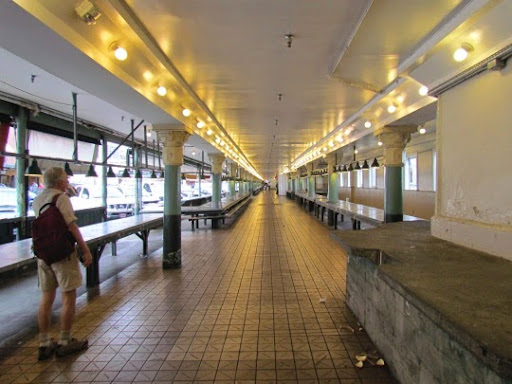
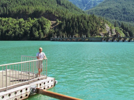
This is why he built 3 gardens in back of the Gorge powerhouse, the gardens that we visited yesterday. By the way these tours are still given today and the highlight is a long boat ride down Lake Diablo. The tours start - in 4 days, 2 days after we leave the area. Here I am at the tour dock waiting for a boat which will not come today.
ViewsfromDiabloLake-6-2014-06-28-20-30.jpg
Unfortunately, as he was building the Ruby Dam, he checked into the Mayo clinic for an operation. All went well but, as he was talking with his wife afterwards, he suffered a massive stroke and died instantly.

The next year, the first phase of Ruby Creek dam was completed, and the dam was named Ross Dam in his honor.
TrailtoRossDam%252526RossLakeResort-1-2014-06-28-20-30.jpg
Ross Dam also had some decorative touches.
ViewsfromDiabloDam-4-2014-06-28-20-30.jpg
The new lake formed by the project was named Ross Lake. He was buried in a crypt in Newhalem, the crypt that we visited yesterday. His wife was buried with him and in front of the crypt is a small garden. But his heritage lives on in the dams that he built to provide electricity to Seattle. Hydro-electric, cheap and non-polluting.

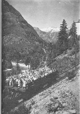
We were able to tour the Diablo Dam area later and see the large incline railway built to get workers to work but later used to take tourists to the top of the hill near Diablo Dam so they could get a better view. This incline could go 558’ up Sourdough Mt. at a 70% grade. Here it is taking some workers to work up the hill.
SkagitRiverHydroelectricProject-3-2014-06-28-20-30.jpg
And here are the tourists dressed in their Sunday best, facing the camera and waving.
dww103.JPG-2014-06-28-20-30.jpg
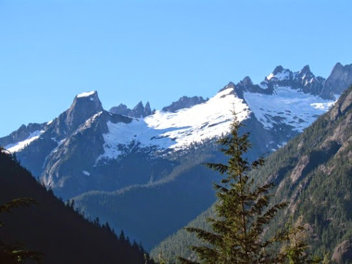
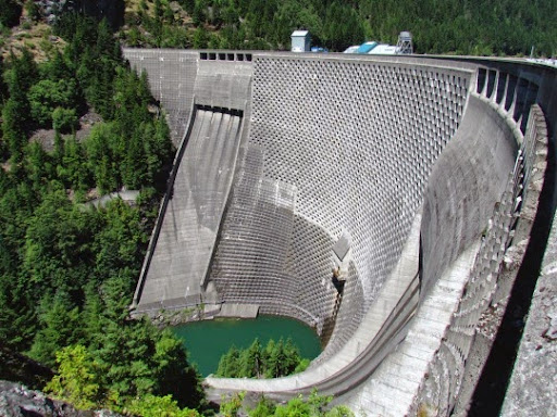
Ross thought big and his dams manifested that. The Diablo Dam itself was the tallest single-arch dam in the world. When it was built, the Diablo’s two main generators were the largest in the world when they were installed in the 1930’s.

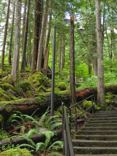
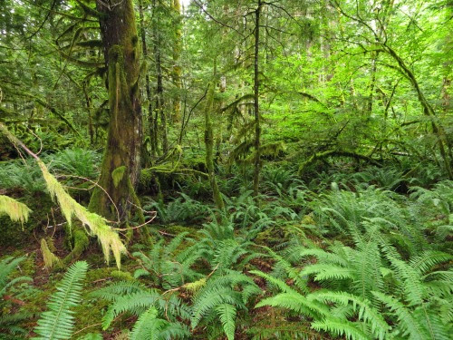
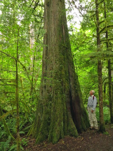
Hmmm. A let up in the rain. Time to go hiking or at least take a walk. Even the walks around here are marvelous.
HikeThunderKnobTrail-2-2014-06-28-20-30.jpg

Friday, June 27, 2014

Newhalem, WA - Rain, Rain, Go Away

We left Seattle in the morning heading north to the road which will take us over the North Cascades. We needed propane, gas and - donuts. We checked Gas Buddy for some diesel stations and found one right off the road. As we were pulling into the parking lot, we stopped and took a look. Not a bustling station, needed some paint, the sign was coming apart and I’m not sure we want to stop here. We like to stop at busy stations so we know that the diesel is turned over a lot. This did not look like one of those. As we were talking it over, a truck drove towards us, really towards us. I noticed that the truck driver was wearing a pink shirt. Cute. Sure enough, the truck driver, a woman, stopped, told us not to go here but to go to a station further up the road. She said she would tell her parents, who drove an RV, not to go here, terribly pot-holed and rutted, the parking lot would tear our suspension out. Thanks, and we took her advice.

The other station had a nice smooth parking lot, clean bathrooms, fresh donuts, cheap propane, diesel and a stand that sold Rainier cherries and raspberries on the other side of it. What more could we want? And, it had this great example of an RV.
NiceLookingRV--2014-06-27-21-38.jpg
To enter the North Cascades National Park we had to drive over this one-way bridge with lights to direct traffic. Watch those bikers.
EntrancetoNorthCascadesNationalPark-1-2014-06-27-21-38.jpg
Very nice campground with quite a few large sites, well, large enough for our 35 footer. There is a nice mixture of tent, trailers, 5th wheels and motor homes. A quintessential dry camping campground - although, given the weather we’ve had recently, we prefer to call it a ‘wet’ campground. Note that Gary is wearing his raincoat. In fact, we’ve had them in the front seat of the car or the RV ever since we left California.
OurCampsite--2014-06-27-21-38.jpg
The North Cascades is really two stories: the story of this beautiful National Park which is almost an unknown park since it has so much wilderness.The names of its mountains range from Mt. Terror, Mt Dispair, Mt Torment, Desolation Peak to Mt. Challenger and Forbidden Peak while its other features boast such names as Devil’s Basin, Hell’s Basin and Deception Pass. Certainly not inviting and, in truth, even though it was designated as a National Park in 1968, until 1972 most travelers couldn’t even get here since there were only wagon tracks and trails for mules or pack horses. Oh, yeah, your snowshoes would work too.

It is also the story of the Skagit Project, in which JD Ross, the Superintendent of Seattle City Light, built 3 huge dams to provide to Seattle in the 1930’s, though both stories are intertwined.
LadderCreekFallsatGorgePowerhouse-7-2014-06-27-21-38.jpg
The North Cascades are a beautiful mountain range in the northern part of Washington bordering on Canada. Often called the North American Alps, you can find mountain lakes, narrow canyons with steep, precipitous sides, rushing mountain streams, jagged mountain ranges, waterfalls of every size from tall to short and from wide to narrow and, above all, you can find more glaciers here than in any other place in the US. Because it is pretty far removed from most of the US, not as many people visit it as other National Parks but it deserves a view.

To get here you’ll travel along the only road through the park, Hwy 20, which, because of the rugged terrain, wasn’t built until 1972. Early attempts failed since when either the road was washed out or avalanches buried it. But, in the 1930’s, under the leadership of Superintendent Ross, the Gorge Dam and the Diablo Dam had been completed and the Ross Dam was in the works. Hundreds of people wanted to come to this area not only to see the dams and the source of their electricity, but also to explore the rugged wilderness that was here. Oops, a road was definitely needed and needed fast - let’s hire some lobbyists. And, the North Cascades Highway Assoc was formed with politicians and business owners from both sides of the mountain range.

Besides, the promise of tourist dollars, the lure of timber profits and the need for reliable transportation to and from the dams all convinced the politicians that a road was needed. It was not an easy task: the route was through narrow canyons next to the roaring Skagit River but it also went over and sometimes through the rugged mountains in its way. Cliffsides needed to be blasted away and the resulting rocks needed for roadbeds. Tunnels were dug. High mountain passes had to be climbed. But, finally in 1972, it was completed, a parade was held and hundreds of cars lined up to be the first over the road. Oh yeah, this road is closed for close to 5 months every year due to the snowfall. It usually closes somewhere around November 26 and usually opens up near April 21. I remember reading this year, as we were making our plans to travel over it, that it was finally opened. Whew.

Ok, we’ve got rugged beauty, a National Park and a road. Let’s get exploring. We first explored the hiking trails in the park. These circle through the park and out to the town of Newhalem, built in 1918 as a construction camp for workers on the Skagit Project. At times, over 300 people lived here and in Diablo, another town built for City Light employees. Fewer than 40 people live in the towns today though you can rent some of the homes and also the bunkhouses built to house tourists in the summer and project employees during the winter months. You can find homes, a community center, a gym, a store (where we found soda, coffee and cookies but which sells convenience items for those living in the area or in the nearby campgrounds).

BUT, the best part is the Ladder Creek Falls Garden and waterfall complex. It’s lies over this suspension bridge,
LadderCreekFallsatGorgePowerhouse-4-2014-06-27-21-38.jpg
behind the power house and up the hill. Here Ross, ever the marketeer, built gardens, walking paths, steps
LadderCreekFallsatGorgePowerhouse-30-2014-06-27-21-38.jpg
and bridges and pools to spotlight the waterfall in the 1930’s.SeattleCityLight%252526JohnRoss-4-2014-06-27-21-38.jpg
He wanted to dazzle people and show them the glories of electricity. Unfortunately the gardens, filled with exotic plants which needed to be housed inside during winter, did not survive the manpower shortages during WWII, but the paths, bridges and waterfall are still a delight.

We then walked across the street where JD and his wife are interred in a crypt surrounded by the plants which he loved so much.
LadderCreekFallsatGorgePowerhouse-8-2014-06-27-21-38.jpg
We then walked back to the campground, crossing this second suspension bridge with a sign on it saying ‘My Dad Built This Bridge’.
SkagitRiver%252526BridgetoTrailoftheCedars-2-2014-06-27-21-38.jpg
How cool is that? The trail goes through some old grow timber with towering Douglas Fir and Cedar trees back to the campground. Oh, yeah, it rained on and off the whole trip. But, being under these trees, we stayed relatively dry.

We also took a trail through the park and you can see how much rain this area has had over the last few weeks.
RiverLoopTrail%252526SterlingMunroViewpoint-7-2014-06-27-21-38.jpg
Not only was the water rushing along, it was overflowing its banks, in one case obliterating the trail. But the ferns covering the forest floor, the talk trees with moss covering their branches made us feel as if we were in a medieval forest. In a moment, the Ewoks will come dashing out between the trees.
RiverLoopTrail%252526SterlingMunroViewpoint-12-2014-06-27-21-38.jpg

RiverLoopTrail%252526SterlingMunroViewpoint-11-2014-06-27-21-38.jpg

RiverLoopTrail%252526SterlingMunroViewpoint-10-2014-06-27-21-38.jpg
We thought this one looked like a spider at the top of the dead stump.
RiverLoopTrail%252526SterlingMunroViewpoint-6-2014-06-27-21-38.jpg
Neat trail through the rain forest of the North Cascades. At the end, at the Visitor Center, we were greeted with this view of the hike mountain ranges around us. Oops, it’s so cloudy and rainy that we couldn’t see the tops today.
RiverLoopTrail%252526SterlingMunroViewpoint-2-2014-06-27-21-38.jpg
Here’s what they looked like several days later on a sunny day.
SterlingMunroViewpoint-4-2014-06-27-21-38.jpg

Wednesday, June 25, 2014

Seattle, WA - Good-by Salt Water

Today is our last chance to be on salt water for about 6 months, when we head on down to the Gulf for our winter jaunt. We could stay in the RV and do bookwork and laundry OR we could take a ferry to - well, anywhere, why not. Eenie, meenie, miney, mo. Hey, let’s go to Bremerton. It’s about 1 hour and there are some things to do there. $.75 for the bus and $4.00 for the ferry each and we’re on our way.
ViewsfromtheFerry-5-2014-06-25-22-14.jpg
What a view of downtown Seattle from the water. But, then, we’re on a ferry and the movement is making the camera jiggle so much that I can’t get a clear picture. But, I’ve got a picture in my mind.
ViewsfromtheFerry-2-2014-06-25-22-14.jpg
Off the ferry, we stopped in a local coffee shop and sat outside on their sidewalk to watch the people walk by. In the coffee shop, we heard someone order a cinnamon, low-fat latte with a single shot. I couldn’t even remember all that. She also ordered a 4-shot espresso. My, someone must not want to sleep for several days. Gary ordered my usual de-caf and, kiddingly, said I wanted a double shot. The barrista said OK and Gary realized that there really might be such a thing as a double-shot de-caf. Never kid with your barrista. Gary and I just order coffee. Pretty simple, pretty plain, easy to say. Meanwhile as we were sitting there, Gary said something about Iowa and a guy at the next table perked up. He was from Iowa also. Then a guy walking by heard our conversation and told us he was also from Iowa.

Finally, we decided that we should do something productive, or at least more active than sitting, and we strolled over to the USS Turner Joy battleship for a tour.
Waterfront%252526DestroyerTour-3-2014-06-25-22-14.jpg
the ship was open for viewing and the local volunteer squad had done added a lot of signs, explanation and had really spiffed it up for touring. We learned while we were touring that this was one of the ships in the Tonkin Gulf when American ships were fired on. However, that this ship was there was not revealed until much later. Here is a note from the Captain to the crew to keep mum about the Turner Joy’s presence.
Waterfront%252526DestroyerTour-10-2014-06-25-22-14.jpg
Bremerton also has a museum devoted to telling the story of the Naval Ship Building Yard there. 2 stories and filled with information.

But, it’s time to head back on the ferry.

We met a couple on the way back with two young kids. I asked the guy where he was from.

‘Minnesota. As him where he’s from,’ he said pointing to his 5-yr old son.

‘Texas.’ he said. ‘Ask her where she’s from,’ said the father pointing to his 8-yr old daughter.

‘Germany.’ she said. ‘Ask her where she’s from,’ said the father pointing to his wife.

‘Mexico.’ she said.

Army family. They move around a lot. He’s done 2 tours in Iraq and 1 in Afghanistan. His first job was removing IED’s from the roads. His second job was in PR and recruitment. Good move. He is a few months from retirement and applying for jobs which will keep him in the same area for a while so his kids will have a home, not another move.

As the ferry bustled back to Seattle, I shut my eyes and listened to the gulls screech above, the ferry blow its horn, the waves lap against the sides of the piers and the clank of metal on masts from the sailboats. I felt the wind in my hair as I stood in the front of the ferry. I felt the tang of the salt air. I’ll have to keep these memories for a while now.

Meanwhile we had one last dinner with our friends, Steve and Kathy. Last week we visited them at their home on Whidbey Island and experienced their wonderful hospitality and their Island Time. Today we met them half-way: in Mulkiteo for lunch.

LunchwithKathy%252526SteveSchwenn-1-2014-06-25-22-14.jpg

Tuesday, June 24, 2014

Seattle, WA - Underground and Aboveground Part 3

Denny Regrade

Next we headed over to the REI flagship store where Gary hoped to buy a hiking shirt. If you have ever been to Seattle you know that it is quite hilly. If you look at a regular map, the streets are all straight, the corners are all at 90 degrees and it leads you to believe that the ground is level and flat. Don’t believe it for a second. Those streets go straight up the hills and down the hills on the other side only to go up again. Very much like a roller coaster. In fact one hill in Seattle is called ‘First Hill’ which implies that there is a second hill and maybe even a third hill. Actually, First Hill is sometimes called ‘Profanity Hill’ because the lawyers who had offices at the bottom had to walk up it to get to the first King County Courthouse. We don’t have to do step-work here, we just walk up the streets.

However, we found a section of town that is pretty flat - or, at least, the hills are much more gradual and not as high. It is the Denny Regrade. Now, I read a series of mystery books by J. A. Jance about a detective in Seattle. He mentions Denny Regrade and I never really knew what it was because I kept getting engrossed in the plot and forgetting to look it up. NOW I know what it was. Back between 1903 and 1911, the Denny hill of Seattle was ‘regraded’ from a huge bluff into a gentle slope.

Firstly, the Denny’s were some of the first white inhabitants of the area and this was their claim. The Denny hill, 62 acres of land north of what was a growing bustling city, was a steep, precipitous, imposing bluff, much too difficult for development and which stymied any growth north of the city. In some cases, the hill rose 190’, much too difficult for horses to climb and thus too difficult for the growth envisioned for Seattle. Finally, city engineer R. H. Thomson convinced most property owners in the area that their property values would soar if the land was much more level. Most bought into his schemes and the blasting began. Beginning in 1903 and again in 1910, Denny Hill was whittled away with continuous blasts of water. 20,000,000 gallons of water a day were pumped in from nearby Union Lake to the top of the hills with enough force to move heavy boulders. Water was also pumped at the bottom to wash away the dirt.

Of course, some refused to go and the city blasted all the land around them, carving out their lots and leaving 100’ high ‘spite’ hills dotting the area. In this case, the dirt was blasted out all around the homes where the owner hadn’t agreed and they then had to shore their homes up. Try stepping out that front door. Eventually, these homeowners ‘caved’ in to the city and their land was regraded also.
960x540-2014-06-24-21-48.jpg
Much of the land blasted away was carted away to fill in tide flats a ways away, the rest was kept on site to use for fill. The march of progress could easily climb up this slope. Yet, the predicted business development never took place. There are businesses in the area but not the towering skyscrapers that Thomson imagined might fill the space. Actually some argue that the regrade inhibited development since there were no more hills for the rich to build on for the views out over the Puget Sound.

And, thus the Denny Regrade of Seattle. We walked through it since it was between where we were and where we were and where we were headed, the flagship REI store. And what a store. 2 stories, with a 3 story climbing rock in the front, a waterfall with a surrounding rain forest in the back
REIFlagshipStore-1-2014-06-24-21-48.jpg
and a dirt bike trail around the building for trying out your new dirt bike. But no Small shirt for Big Gar. Oh well.

We walked back through the city to pick up the bus which was the express to Bellevue. We stopped at Pike Market on the way back - empty now with all the merchants gone home and the tourists at dinner.
PikePlaceMarket-4-2014-06-24-21-48.jpg
We liked the signs on the bathrooms here too.
PikePlaceMarket-3-2014-06-24-21-48.jpg PikePlaceMarket-1-2014-06-24-21-48.jpg
Heading Home

We have been amazed at how cheap the bus fares are into Seattle. Obviously, they are trying to promote bus use and, boy, are they ever succeeding. The buses are full in the morning and evening when we use them. We have also seen lots of people lining the streets during the day waiting to get on their bus. I can’t remember what the rate for ‘regular’ people is but we seniors can get into town from Bellevue for $.75. that’s 75 cents each. Gary and I can go into town and back out again for $3.00. Parking in the city is also very expensive. 2 hours max and $8.00 for this 2 hours. Maybe tourist areas like Pike Place are less but we have also seen early bird specials of $14.00 for a day’s parking. Low bus fares, high parking rates - and buses are popular.

Today we had a bus driver who welcomed us aboard his bus. Nice personal touch.

Monday, June 23, 2014

Seattle, WA - Underground and Aboveground Part 2

Klondike Gold Rush National Park

We’ve all heard of the 49’ers, the gold rushers in 1849 heading to California. But, I haven’t heard as much about the Klondike gold rush in 1889, heading up to the Klondike in northern Canada. Well, now I know much more about that and the part that Seattle played in it because we visited the Klondike National Park after our Underground Tour.

Gold. Is there any other word that can make normal people turn crazy, sell everything they have, leave their families and head off into unknown territory for what they think they might find, if they are incredibly lucky? Well, maybe chocolate, but the pull of gold is much stronger. And that was the word in the air in 1897. Gold had been discovered on the Klondike in northern Canada and the pull was strong. Some miners had arrived in Seattle with 2 TONS of gold with them that they had discovered near Dawson City, CA. ‘Oh, boy, gotta get up there’, said thousands. And off they went. Here they are, lined up for the ship.
KlondikeGoldRush-23-2014-06-23-11-37.jpg
There were 4 ways to get there, 1, the water route which cost too much and the 3 land routes which were treacherous, long, cold and extremely difficult. But that did not deter many. Because many were arriving without enough supplies to last more than a few weeks, the Canadian Mounties required that each person making the trip into Canada to the Klondike had to have a years worth of supplies which weighed close to 2 tons. Here is a list. Note that there is a lot of flour, bacon, beans, potatoes, salt and fat. Yummy. Short on veggies and fruit although there is a listing for dried fruit.
KlondikeGoldRush-22-2014-06-23-11-37.jpg
One of the land routes is pictured here. A boat could get you to a small village called Dyea (Die - ee’) but you would have to unload your 2 tons of supplies, haul them up this pass and down the trail on the other side. At the top of the 35% grade pass were 1500 steps, the Golden Stairs, your own personal ‘Stairway to Heaven’. Before making this climb, at the bottom of the hill, the miners repacked their 2 tons into 65-lb packs and made between 30 and 40 trips up the Golden Stairs with their goods, stacked them up, slid down the other side of the mountain and picked up another 65-lb bundle for another round trip. And, by the way, after they had made their 30-40 trips, they were still not at Dawson City. That was many more miles and about 3 months ahead.
KlondikeGoldRush-14-2014-06-23-11-37.jpg
The trail on the other side of the Golden Stairs used to be a good trail. But thousands of prospective miners had worn it down so that now it was a muddy, slushy, rocky mire. So many horses had died on the trail that it was called Dead Horse Trail.

In Dawson City, prices were high, bunks were few, bars were on every block, brothels lined the side streets and there were con men just waiting to take a prospective miner to the cleaners. One egg cost $5, one onion $2, whiskey $40 a gallon. And, guess what? Most of these men reached the gold fields after they had all been claimed and most played out. Most just sold their gear for steamboat fare back home.

The natives in the Klondike area suffered terribly: traditional homelands, fishing area and hunting areas were destroyed, the miners brought diseases they had no defenses against and, even though some found jobs as packers, they were paid very little and were unused to a cash economy.

HOWEVER, and here’s the point - Seattle made bundles of money outfitting the miners. Some of the outfitting stores in Seattle had so many supplies for sale that they had to pile them 10’ high outside their stores. By 1898, $30,000,000 (or about $600,000,000 in today’s dollars) in supplies had been sold. This ensured Seattle’s place as a regional trade center.
KlondikeGoldRush-25-2014-06-23-11-37.jpg
Remember those sidewalks that the city couldn’t build after the fire? Well, here’s when the money began to pour in. Taxes on supplies, taxes on whiskey, taxes on prostitution and Seattle had enough to build their sidewalks.

Smith Tower

We then visited the Smith Tower built by Lyman Cornelius Smith and his son in 1914. You might not know of Lyman C Smith, but I’ll bet you’ve heard of Smith Corona typewriters. Yep, that Smith. And with that fortune he built the tallest office building in the world out side of New York City, 39 stories and 489’, (this is what Wikipedia says - the Smith literature says 42 stories and 422’ - who am I to believe? I do know we got out at the highest story at the 35th. Above is was only the triangular top - where there is a pretty exclusive penthouse. Who would have thought counting stories in a building was so difficult.) At least, it was the tallest in 1914.

Here is an older picture of it. The building in front has been torn down and replaced with what the locals call the Sinking Ship Parking Garage. One look at it will tell you how it got that nickname.
UndergroundSeattleTour-2-2014-06-23-11-37.jpg

SmithTowerElevator%252526Views-27-2014-06-23-11-37.jpg
It began a few years earlier when he visited Seattle in 1909 and returned home wanting to build a 14-story office building in the boondocks of Seattle. His son, Burns Lyman Smith, had seen how much publicity other companies had gotten when they had built skyscrapers and had much loftier plans - 39 stories. That’s going make us famous and help sales of our typewriter, he reasoned. It was designed to be a 21 story tower rising from a 21 story structure and an architectural firm that had never designed anything higher than a few stories was chosen. Hey, you’ve got to start somewhere.

I loved the pictures on the bathroom doors. Pretty classy.
SmithTowerElevator%252526Views-7-2014-06-23-11-37.jpg SmithTowerElevator%252526Views-8-2014-06-23-11-37.jpg
The building still has real live human elevator operators. When was the last time you saw that?
SmithTowerElevator%252526Views-2-2014-06-23-11-37.jpg
But they built an iconic structure that has lasted for a century and is a centerpiece for the Pioneer District of Seattle. Unfortunately Mr. Smith did not live to see the $1,000,000 building completed but his son was there when 4000 Seattle-ites came to ride up to the 35th story to gape at the city they lived in. Their views were 360 degrees and ranged from the waterfront to the mountains. Our views today are quite different. Firstly, we can’t see as far since there are now taller structures. Secondly, there is so much more city now than there was then. But they are still marvelous views.
SmithTowerElevator%252526Views-5-2014-06-23-11-37.jpg
Time for lunch and we found a quiet park with a waterfall running through it.
WaterfallGarden-1-2014-06-23-11-37.jpg
Hey, would you guess that a soccer game was going on? Here’s the alley in back of a bar with the TV set us and people crowded around it.
WatchingWorldCupSoccerOutdoors--2014-06-23-11-37.jpg
Remember in the movie Mozart when the king told Mozart that he had one note too many? That his Symphony would be perfect if he removed one note? Well, I’m not comparing this blog to Mozart’s symphony by any means but the king might say it is also too long. Now, since it is so long, I’ve added a third section.

Sunday, June 22, 2014

Seattle, WA - Underground and Aboveground Part 1

I’m sure you knew that there would be a history story somewhere during our trip to Seattle and here it is. And, it ain’t all pretty. We learned about exploding toilets and skid rows. We learned about rats and wooden drinking water pipes. But it was all fun and followed our walk through early downtown Seattle. We began the day with a tour of the Underground in Seattle. Begin at the bottom, my mother always said, and work your way up.

The Seattle Underground

The tour began back in the 1960’s with a newspaper columnist for the Seattle Times called Bill Speidell. He got a letter once from a reader asking about the Seattle underground. He knew nothing about it but told her he would do some research. When he got back to her he invited her to come (in a newspaper story) with him on a tour of the underground at 3:00 on Saturday - and 500 people showed up (he must have had a lot of readers). He collected $1.00 from everyone and gave them a tour - a tour which is still given today and is one of the most popular tourist attractions in Seattle.

However, he is also known as one of the most fervent preservationists in Seattle, wanting to restore and preserve the Pioneer Square area where Seattle actually began. By the 1960’s, this area, like many areas in central cities in the United States was run-down, in disrepair and being abandoned as people looked to the suburbs for homes and businesses. Others joined his cause and today Pioneer Square is full of activity from restaurants, parks, waterfalls, hotels, shops and - tours.

Here we are in the tour meeting room getting some background. Note the marvelously carved bar in the background.
UndergroundSeattleTour-57-2014-06-22-20-49.jpg
But it began back in the 1850’s when Seattle’s first settlers built their homes in the lowlands near the bay, of course, flat and level with a water view. What more could one want? Today we call these areas ‘tidal flats’ and they rise and fall with the tide - twice a day. Not a place to put a house. Obviously plumbing was a problem. They first used hollowed out wooden logs for water pipes to get their water to their homes from the wells.
UndergroundSeattleTour-13-2014-06-22-20-49.jpg
Their sewage emptied directly into the Sound although when the tide came in toilets had a nasty habit of filling up. Then they began to print the tide tables in the local newspaper to try to end that problem.

One of the city’s early settlers was David ‘Doc’ Maynard who wanted the city to grow. First he changed the name of the small settlement from Duwumps to Seattle, naming him after a friend of his, Chief Seathl of the Duwamish and Suquamish tribes. (And, really, who wants to live in a city named Duwumps?) Next to sold some of his substantial parcel of land cheaply to draw more people but also gave a large parcel to Henry Yessler who came to build a lumber mill in the area. Oh, good. Now we have a lumber mill to employ people and to provide building materials for our home. And, hey, let’s put all the left-over saw dust into the streets to mat it down. Early recycling here. But, what a mess. And, what the horses do this this fine sawdust, I’m not even going to explain.

When the trees near the shoreline ran out, Yessler moved up the hill, cleared it, greased the logs and skidded them down to his mill. ‘Skid’ row? Sure enough, this road later became one of the less desirable parts of the city as the gentry moved up the hill.

But the town was booming, it was a city of 30,000 by June of 1889, people were moving in, buildings were going up. One estimate is that in the first half of 1889, Seattle was gaining 1,000 new residents per month; in March alone, there were 500 buildings under construction, most of them built of wood. Surprise. But what about those plumbing problems, that twice-daily flooding, the dirty streets, the rats? Who cares? Easy to ignore little things like that when you’re bustling, growing and adding new businesses every day.
UndergroundSeattleTour-4-2014-06-22-20-49.jpg
It took a devastating fire in June of 1889 to bring about some much needed changes. The fire began when an assistant furniture maker was heating some glue, heated it too much and it boiled over, caught fire, spread to the floors covered in turpentine and wood chips. Then, he threw water on the fire, thinned the turpentine so it spread further. Whoosh. The fire grew. Next door was the liquor store - oops, that only added fuel to the fire. Here’s a picture after the fire. Note the melted rails - the fire was that hot. But also note that hardly any buildings were left. A clean slate.
UndergroundSeattleTour-27-2014-06-22-20-49.jpg
When the volunteer fire department came and hooked up their hoses to the few fire hydrants with the small wooden pipes, the fire had spread far beyond the ability of that water. They then tried to use the bay but the tide was out and their hoses were too short. And, did I mention that the Fire Chief was out of town attending a fire convention? In the end the fire wiped out 25 city blocks, along with the wharf, the lumber mill and all the wooden homes and wooden buildings in the area. Jobs and property losses were huge. No lives were lost in the fire although it was later estimated that 1 million rats were killed. Well, one problem solved.

But the city took the opportunity to improve and eliminate some of the old problems. 2 major rules: build out of brick or stone, raise the streets up 22’. Businessmen rebuilt in a jiffy. The city took longer to rebuild the streets to the required 22’ level. First they lined the streets with 22’ high walls and filled them in. OK, now we’ve got the shops and businesses and the streets but what about the sidewalks? Oops, the city was out of money. So you’ve got a moat around all the business blocks with the streets on one side and the buildings on the other. Let’s put in ladders so people can climb up to the street, cross it and down the ladder on the other side to businesses on the next block. Luckily, businesses had put in an entry door on what used to be the first level so people could get into the stores. The whole area looked like a giant waffle.

Here are a few pictures of the original sidewalk. Note the brick walls on one side (that’s the street side) and the business store fronts with doors and windows on the other side. The sidewalk was in the middle - and it is covered now but still open enough to walk through.
UndergroundSeattleTour-33-2014-06-22-20-49.jpg

UndergroundSeattleTour-28-2014-06-22-20-49.jpg

UndergroundSeattleTour-30-2014-06-22-20-49.jpg
Here’s what they used for lighting on the lower level.
UndergroundSeattleTour-55-2014-06-22-20-49.jpg
And, here’s what it looked like from the underground. It did give a lot of light.
UndergroundSeattleTour-40-2014-06-22-20-49.jpg
And this went on for 8 years. But there were other improvements: they eliminated the old wooden water pipes and installed a city water department, they also changed the volunteer fire department to a professional one and put in more hydrants. Good going, guys.

Oh, by the way, did I mention the census that the mayor took in the in late 1800’s? Well, lots of lumbermen as he had thought since that was a huge industry but there were also a lot of seamstresses - and they all worked in the same house. Hmmm.

So, where did Seattle get the money to finish off the sidewalks? Glad you asked that question. That leads us to our next stop for the day: the Klondike National Park right in Pioneer Square. But that’s a story for the next blog.