
Time for another hike. We’re running through our repertoire. Today into the South Mountains for a fun hike - skinnying through the Fat Man’s Pass. We weren’t the only ones in the parking lot but we were the only ones who took off to the left to hike up Geronimo Trail. Nice trail right up a bouldered canyon. The trail winds around a bit and we got lost in one of the washes. (We were following lots of other footsteps - I guess they were lost, too.) We hiked a ways but realized that we were going the wrong way. However, we found some cool petroglyphs in the wash that we wouldn’t have seen if we hadn’t taken the wrong trail.


Nice views of Phoenix as we climb higher and higher.
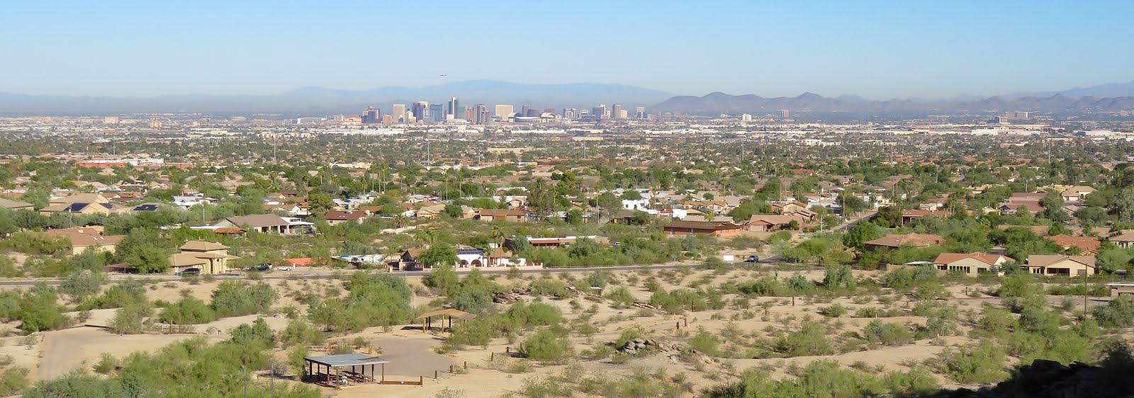
Back on the official trail, we noticed several false tops. You look up and think you see the ridge line right ahead of you - not too far. 'Hey, look, we're almost there.' You climb up to that ridge line and find another ridge line right ahead of you. You get up to that and find still another ridge line. Finally the top, where there is a nice bench (and, a parking lot for those who didn't want to climb).

Another hiker named Henry came up while we were checking the view and took this shot of up overlooking the Phoenix area. Difficult to distinguish but off to my left is a brown 3-humped hill called Camelback Mt. If you’ve ever been to or hiked in the Phoenix area, you’ve probably hiked up that. We did a few years ago.

Off to the other side we saw not only the usual yellow-brown smog over the city this huge plume of black smoke. Never heard what it was from

Look at the blooms on this ocatillo. Who says the desert is brown and dead?

One of our goals was Hidden Valley and to get into that

We had to skinny through Fat Man’s Pass. I had to take my pack off for this one. At one time I tried to turn my foot but the rocks were closer than my foot is long. No way, I had to keep sidling out the way I had come in, my pack in my right hand.


A balanced rock.

Then we decided that we wanted a longer hike (what were we thinking?) and took a right at one of the trail markers. That trail plummeted down and, you know if there’s a big down, there’s going to be a big up. And, the trail makers must have forgotten about switchbacks. Right straight up those hills. I huffed and puffed and stopped a few time - ‘to take pictures’ I said. Ha. To try to catch my breath.
Then we saw this sign - only 1.36 miles left and it’s all down hill (we’re at the top where the 1959’ is and we're going to be heading to the left, towards the bottom of the hill where our car is). Whew.

Time for a soda. Fun hike and we’ll do it again - but I had forgotten about that plummeting descent and that vertical assent. Know what? I'll probably have forgotten it the next time we get to that same junction.
No comments:
Post a Comment